-by Yuri Hauswald
Do you want to know a secret? The area around Fort Bragg has some of the most incredible mountain biking you’ll find anywhere. But that’s the key: finding it.
The North Coast has all the makings of a Mountain Biking Mecca. A wide range of trails, from steep and thrilling to moderate and leisurely that roll through tall mountains and dense forests with cool coastal air and stunning ocean views. Then there’s a laid-back town with casual places to eat, drink, recover and rest up for your next ride.
Fortunately, finding it is exactly what I set out to do – to help people discover this amazing region, its unique geography, climate and land managers, along with a distinctly North Coast personality and vibe that all come together to put Fort Bragg well on its way to Mountain Bike Mecca status.

In the audio clips below you’ll hear from the people in the Fort Bragg biking community. They’ll share their favorite trails, tips for newcomers, and stories of the challenges and rewards of mountain biking in and around Fort Bragg. So sit back, relax and enjoy one of the best, emerging mountain biking destinations in California.
Roo Harris
One of the original trail pioneers in Jackson Demonstration State Forest.
Dan Sweet
Dan is the current president of the Mendocino Coast Cyclists and an avid mountain biker.
Myke Berna
Myke, a local bike shop owner, is a former president of the Mendocino Coast Cyclists and lives in the Jackson Demonstration State Forest.
Kevin Conway
Kevin is the manager of the Demonstration State Forests Program for CAL FIRE.
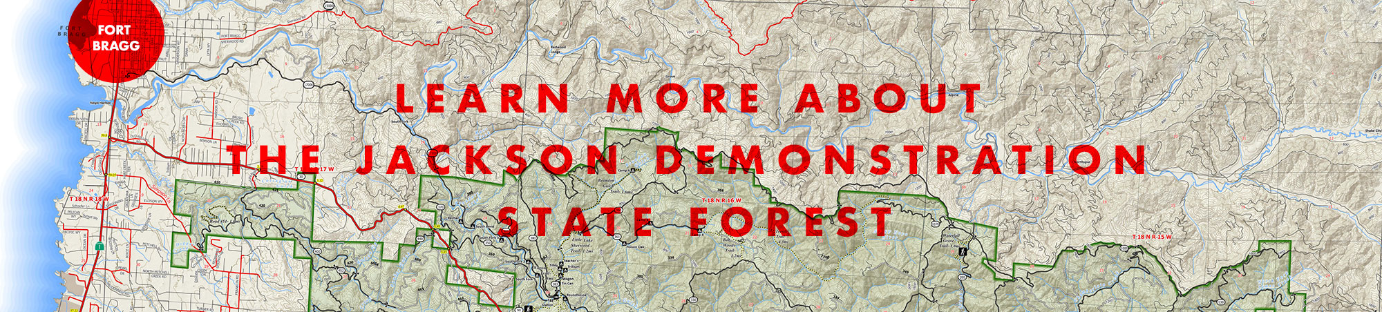
Mountain Bike Trail Maps
Jackson Demonstration State Forest is big, and mapping the trails to date has been a joint effort between varied entities, from local riders and organizations like the Mendocino Coast Cyclists and CAL FIRE. Below are a few maps from reliable sources that can get you started on the most well-known, and most-loved, trails in the region. First, here are a few important things to consider when riding the forest that go beyond the common courtesies and precautions of safe mountains biking on multi-use trails:
• Carry your cell phone with an application like Avenza to find your way around, since many trails aren’t marked.
• Consider carrying a GPS device such as Garmin to communicate in emergency situations, as cell phone reception is spotty.
• Stay on established routes. Don’t cut through the forest or create new trails.
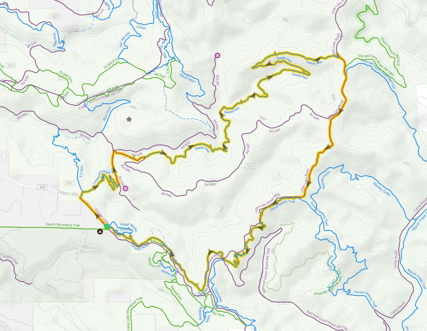
Lindquist – Sweet Pea
– Observatory Trail
A popular loop is to drop down Lindquist, ride up Sweetpea (recently upgraded and officially adopted) , and take Road 408 around to the top of Observatory Trail. Flow down those graceful turns of Observatory and then follow Parallel or meander through Jiro’s Playground back to your car at EOP. This (+ or -) 15-mile loop takes you on three of the Mendocino Coast Cyclist’s flagship trails, which also are some of our most popular, with a nice variety of riding. The loop is moderately difficult, with about 1,800 ft of climbing.
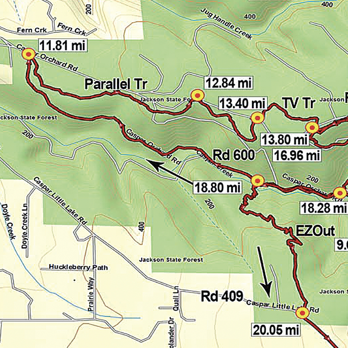
Woodlands To The Scales
This 25+ mile ride route with just under 3,500′ of elevation gain originates in the Mendocino Woodlands State Park and proceeds to climb up to the ridge on Rd 408. The destination ultimately goes to Rd 500 in Caspar, AKA: the “Scales” area and back. An all-day intermediate adventure!
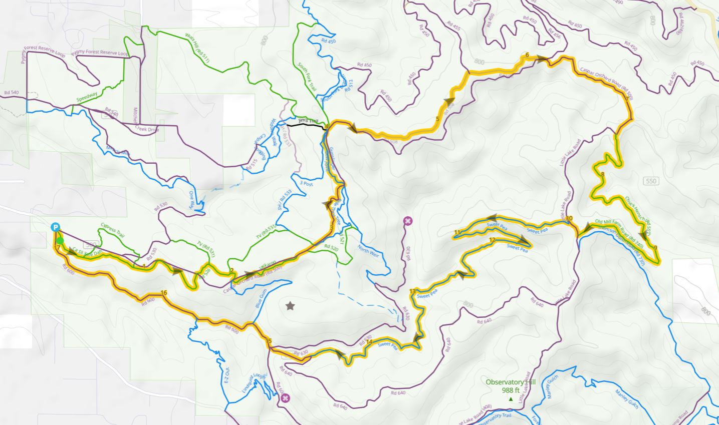
Scales to Sweet Pea
This route includes Gunslinger, Chuck Hensch and Sweet Pea. If you enjoy some aerobic climbing, head up Ride Thu Tree, rather than taking 508 from Jackaroo to Gunslinger. The route comes straight back to your car on 600. The full route is considered moderately difficult, with 2,000 ft of climbing and 18 miles of travel.